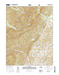
2016 Map of Stokesville
USGS Topo · Published 2016About this map
Stokesville sits at the confluence of the North River and Little River, serving as a gateway to the high ridgelines of the George Washington National Forest. This 2016 survey captures the intersection of early industrial history and modern conservation, notably tracing the path of the Old C & W Railway Rd near the North River Gap. The landscape is defined by its water resources, from the recreational waters of Todd Lake and Elkhorn Lake to the vital Staunton Reservoir tucked beneath Trimble Mtn. Further south, the rural character of Augusta County remains visible through traditional community hubs like Stover and Stribling Springs, where roads such as Oak Hill School Rd and Stover Shop Rd hint at the locations of former local institutions. The steep-walled drainages of Daggy Camp Hollow and Bear Draft illustrate the challenging terrain that shaped early settlement patterns and mountain pass routes through Jennings Gap.
Find a feature on this map
78 named features on this map. Tap any name to fly to it.
Don’t see what you’re looking for? This feature index may not catch every label — zoom into the map to look around manually.
Map Details
Editions of this 2016 Stokesville Map
This is the sole edition of this map. No revisions or reprints were ever made.
Other maps of this area

1894 · Staunton
USGS Topo · 1:125,000

1924 · Mc Dowell
USGS Topo · 1:62,500

1943 · Craigsville
USGS Topo · 1:62,500

1944 · Parnassus
USGS Topo · 1:62,500

1944 · Mc Dowell
USGS Topo · 1:62,500

1944 · Staunton
USGS Topo · 1:62,500

1945 · Craigsville
USGS Topo · 1:62,500

1946 · Mc Dowell
USGS Topo · 1:62,500

1947 · Staunton
USGS Topo · 1:62,500

1947 · Parnassus
USGS Topo · 1:62,500