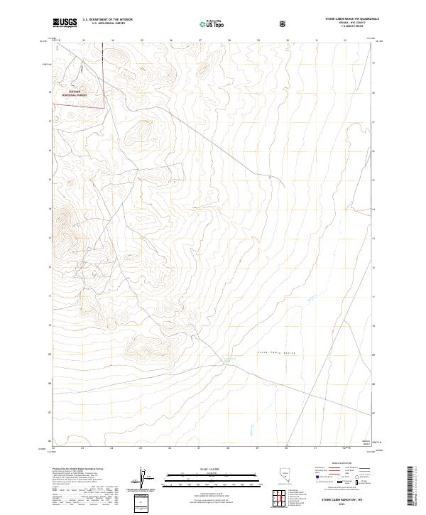
2021 Map of Stone Cabin Ranch SW
USGS Topo · Published 2021About this map
Toiyabe National Forest land dominates the northwestern corner of this high-elevation landscape in Nye County, Nevada. The terrain is characterized by the wide drainage patterns of Stone Cabin Valley, where the ephemeral Willow Cr meanders across the arid basin. Water sources are scarce in this part of the Ralston Desert, making small features like Coyote Hole Spring critical landmarks for understanding the historical movement of people and livestock through the region. This 2021 update preserves the exact township and range boundaries, such as t3n r47e, which have governed land management in this remote stretch of the Great Basin for generations.
Find a feature on this map
9 named features on this map. Tap any name to fly to it.
Don’t see what you’re looking for? This feature index may not catch every label — zoom into the map to look around manually.
Map Details
Editions of this 2021 Stone Cabin Ranch SW Map
This is the sole edition of this map. No revisions or reprints were ever made.
Other maps of this area

1908 · Kawich
USGS Topo · 1:250,000

1942 · Cactus Range
USGS Topo · 1:125,000

1952 · Stinking Spring
USGS Topo · 1:62,500

1952 · Cactus Peak
USGS Topo · 1:62,500

1954 · Goldfield
USGS Topo · 1:250,000

1955 · Goldfield
USGS Topo · 1:250,000

1956 · Tonopah
USGS Topo · 1:250,000

1958 · Goldfield
USGS Topo · 1:250,000

1959 · Tonopah
USGS Topo · 1:250,000

1962 · Goldfield
USGS Topo · 1:250,000