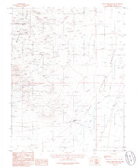
1986 Map of Stone Cabin Ranch SW
USGS Topo · Published 1986About this map
Toiyabe Range and Monitor Range peaks dominate this high-desert landscape in central Nevada during the mid-1980s. The terrain transitions from these rugged uplands into the broad expanse of the Stone Cabin Valley, where drainage patterns like Stone Cabin Creek define the arid floor. Significant mining activity is evidenced by numerous prospects and multiple mine shafts concentrated along the western slopes, indicating a history of mineral exploration within the boundaries of the Toiyabe National Forest.
Find a feature on this map
10 named features on this map. Tap any name to fly to it.
Don’t see what you’re looking for? This feature index may not catch every label — zoom into the map to look around manually.
Map Details
Editions of this 1986 Stone Cabin Ranch SW Map
This is the sole edition of this map. No revisions or reprints were ever made.
Other maps of this area

1908 · Kawich
USGS Topo · 1:250,000

1942 · Cactus Range
USGS Topo · 1:125,000

1952 · Stinking Spring
USGS Topo · 1:62,500

1952 · Cactus Peak
USGS Topo · 1:62,500

1954 · Goldfield
USGS Topo · 1:250,000

1955 · Goldfield
USGS Topo · 1:250,000

1956 · Tonopah
USGS Topo · 1:250,000

1958 · Goldfield
USGS Topo · 1:250,000

1959 · Tonopah
USGS Topo · 1:250,000

1962 · Goldfield
USGS Topo · 1:250,000