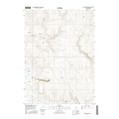
2017 Map of Stonehouse Creek
USGS Topo · Published 2017About this map
Pleasant Valley Cem serves as a quiet focal point in this high-desert landscape of Owyhee County, situated near the headwaters of Stonehouse Creek. This 2017 survey reveals a complex network of springs and drainages vital to the cattle ranching history of the region. Distinctive geological markers such as Split Rock and Split Rock Canyon punctuate the northern terrain, while the broad expanse of Noble Basin suggests the open range character of the Idaho-Oregon borderlands. The map details a landscape where water is the primary navigator, traced through numerous named sources like Ibex Spring, Dead Horse Spring, and Thorne Spring. Remote access is defined by rugged corridors like Flint Rd and Trout Creek Rd, which connect the scattered natural landmarks of Pleasant Valley to the broader drainage of Jordan Creek.
Find a feature on this map
47 named features on this map. Tap any name to fly to it.
Don’t see what you’re looking for? This feature index may not catch every label — zoom into the map to look around manually.
Map Details
Editions of this 2017 Stonehouse Creek Map
This is the sole edition of this map. No revisions or reprints were ever made.
Other maps of this area

1892 · Silver City
USGS Topo · 1:125,000

1894 · Silver City
USGS Topo · 1:125,000

1898 · Silver City
USGS Topo · 1:125,000

1955 · Jordan Valley
USGS Topo · 1:250,000

1955 · Boise
USGS Topo · 1:250,000

1957 · Jordan Valley
USGS Topo · 1:250,000

1958 · Boise
USGS Topo · 1:250,000

1958 · Jordan Valley
USGS Topo · 1:250,000

1962 · Boise
USGS Topo · 1:250,000

1965 · Rooster Comb Peak
USGS Topo · 1:62,500