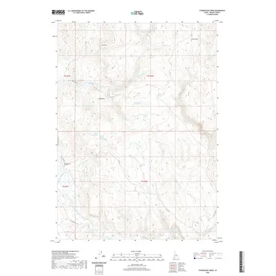
2020 Map of Stonehouse Creek
USGS Topo · Published 2020About this map
Noble Basin and the surrounding high country of Owyhee County define this landscape, where a dense network of springs and creeks supports high-desert life. The topographic survey reveals a reliance on isolated water sources, naming dozens of unique points such as Summit Spring Number One, Dead Horse Spring, and Thorne Spring. These water features are essential landmarks in a region largely defined by its drainage basins and ridges, including the prominent Long Ridge and the geological marker at Split Rock. Human presence is mapped through a sparse network of mountain roads like Flint Rd and S Mountain Rd, which connect remote ranching or grazing areas. The presence of the Pleasant Valley Cem near Stonehouse Cr provides a poignant genealogical anchor, suggesting the long-term habitation of families who managed these lands long before modern surveying.
Find a feature on this map
41 named features on this map. Tap any name to fly to it.
Don’t see what you’re looking for? This feature index may not catch every label — zoom into the map to look around manually.
Map Details
Editions of this 2020 Stonehouse Creek Map
This is the sole edition of this map. No revisions or reprints were ever made.
Other maps of this area

1892 · Silver City
USGS Topo · 1:125,000

1894 · Silver City
USGS Topo · 1:125,000

1898 · Silver City
USGS Topo · 1:125,000

1955 · Jordan Valley
USGS Topo · 1:250,000

1955 · Boise
USGS Topo · 1:250,000

1957 · Jordan Valley
USGS Topo · 1:250,000

1958 · Boise
USGS Topo · 1:250,000

1958 · Jordan Valley
USGS Topo · 1:250,000

1962 · Boise
USGS Topo · 1:250,000

1965 · Rooster Comb Peak
USGS Topo · 1:62,500