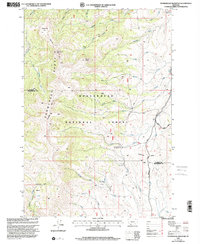
1997 Map of Stonehouse Mountain
USGS Topo · Published 2001About this map
The high ridges of the Snowcrest Range define this portion of the Beaverhead National Forest, where the complex drainage systems of the Ruby River and its numerous forks meet the Centennial Divide. This landscape, documented in the late 1990s, reveals a high-altitude wilderness oriented around peaks like Stonehouse Mountain and Mount Carey. A single outpost of early forest management, the Divide Creek Guard Station, sits along the creek that separates the northern and southern watersheds. Movement through this difficult terrain is marked by the Gilbert Trail and the Eureka Basin Road, tracing routes that have long served as the primary access for remote ranching and forest operations. The map also delineates the boundary of Madison Co Beaverhead Co, showing how political lines follow the natural height of land across meadows such as Honeymoon Park.
Find a feature on this map
39 named features on this map. Tap any name to fly to it.
Don’t see what you’re looking for? This feature index may not catch every label — zoom into the map to look around manually.
Map Details
Editions of this 1997 Stonehouse Mountain Map
This is the sole edition of this map. No revisions or reprints were ever made.
Other maps of this area

1950 · Lower Red Rock Lake
USGS Topo · 1:62,500

1950 · Monument Ridge
USGS Topo · 1:62,500

1955 · Dubois
USGS Topo · 1:250,000

1955 · Ashton
USGS Topo · 1:250,000

1958 · Dubois
USGS Topo · 1:250,000

1958 · Ashton
USGS Topo · 1:250,000

1960 · Ashton
USGS Topo · 1:250,000

1968 · Stonehouse Mountain
USGS Topo · 1:24,000

1968 · Antelope Peak
USGS Topo · 1:24,000

1968 · Antone Peak
USGS Topo · 1:24,000