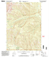
2001 Map of Stonehouse Mountain
USGS Topo · Published 2004About this map
Stonewall Mountain and Red Mountain define the high country of the Helena National Forest in this 2001 revision. The landscape is marked by the extractive history of the Lincoln Ranger District, featuring sites like Copper Camp and the Cotter Mine. High-altitude water bodies, including Copper Lake and Upper Copper Lake, feed a complex drainage system where Stonewall Creek and Copper Creek flow toward the lower valleys. The northern portion of the map transitions into the Scapegoat Wilderness, an area defined by its lack of infrastructure compared to the mining-related tracks found further south. This survey combines 1958 topography with imagery updated at the turn of the 21st century, showing the persistence of early mining landmarks within the protected federal forest boundary.
Find a feature on this map
25 named features on this map. Tap any name to fly to it.
Don’t see what you’re looking for? This feature index may not catch every label — zoom into the map to look around manually.
Map Details
Editions of this 2001 Stonehouse Mountain Map
This is the sole edition of this map. No revisions or reprints were ever made.
Other maps of this area

1950 · Lower Red Rock Lake
USGS Topo · 1:62,500

1950 · Monument Ridge
USGS Topo · 1:62,500

1955 · Dubois
USGS Topo · 1:250,000

1955 · Ashton
USGS Topo · 1:250,000

1958 · Dubois
USGS Topo · 1:250,000

1958 · Ashton
USGS Topo · 1:250,000

1960 · Ashton
USGS Topo · 1:250,000

1968 · Stonehouse Mountain
USGS Topo · 1:24,000

1968 · Antelope Peak
USGS Topo · 1:24,000

1968 · Antone Peak
USGS Topo · 1:24,000