
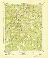
2010 Map of Stony Creek
USGS Topo · Published 2010About this map
The town of Stony Creek serves as the focal point for this Tidewater Virginia landscape, where the namesake Stony Creek flows toward its confluence with the Nottoway River. The terrain is characterized by an intricate drainage system including Sappony Creek, Southwest Swamp, and Bolling Swamp, which historically dictated the placement of early settlements and roads. Local history is anchored by sites such as Winfields Mill and the southern riverside location of Fort Nottoway. Family genealogy is supported by the identification of Peagram Cemetery and Sappony Cemetery, alongside old road networks like Jones Branch Rd and Reed Rd. Significant water control features like Morgans Dam and Spiers Dam indicate the area's long-standing relationship with its water resources, while the presence of the Huske settlement further south highlights the rural distribution of the Sussex County population in this era.
Find a feature on this map
51 named features on this map. Tap any name to fly to it.
Don’t see what you’re looking for? This feature index may not catch every label — zoom into the map to look around manually.
Map Details
Editions of this 2010 Stony Creek Map
This is the sole edition of this map. No revisions or reprints were ever made.
Other maps of this area

1894 · Petersburg
USGS Topo · 1:62,500

1897 · Amelia
USGS Topo · 1:125,000

1919 · Jarratt
USGS Topo · 1:62,500

1919 · Mc Kenney
USGS Topo · 1:48,000

1921 · Mc Kenney
USGS Topo · 1:62,500

1943 · Mc Kenney
USGS Topo · 1:62,500

1943 · Dinwiddie
USGS Topo · 1:24,000

1943 · Richmond
USGS Topo · 1:250,000

1944 · Reams
USGS Topo · 1:31,680
1944 · Dinwiddie
USGS Topo · 1:31,680