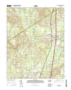
2016 Map of Stony Creek
USGS Topo · Published 2016About this map
Stony Creek serves as a central hub on this 2016 survey, situated where the interstate corridor meets local routes like Main St and Cedar Rd. This Sussex County landscape is defined by its extensive wetlands and drainage systems, where the Nottoway River and its tributaries carve through the terrain. Notable hydrologic features include the broad Southwest Swamp, Peaquarter Swamp, and Bolling Swamp, which reflect the low-lying, water-dense geography of the region.
Find a feature on this map
72 named features on this map. Tap any name to fly to it.
Don’t see what you’re looking for? This feature index may not catch every label — zoom into the map to look around manually.
Map Details
Editions of this 2016 Stony Creek Map
This is the sole edition of this map. No revisions or reprints were ever made.
Other maps of this area

1894 · Petersburg
USGS Topo · 1:62,500

1897 · Amelia
USGS Topo · 1:125,000

1919 · Jarratt
USGS Topo · 1:62,500

1919 · Mc Kenney
USGS Topo · 1:48,000

1921 · Mc Kenney
USGS Topo · 1:62,500

1943 · Mc Kenney
USGS Topo · 1:62,500

1943 · Dinwiddie
USGS Topo · 1:24,000

1943 · Richmond
USGS Topo · 1:250,000

1944 · Reams
USGS Topo · 1:31,680
1944 · Dinwiddie
USGS Topo · 1:31,680