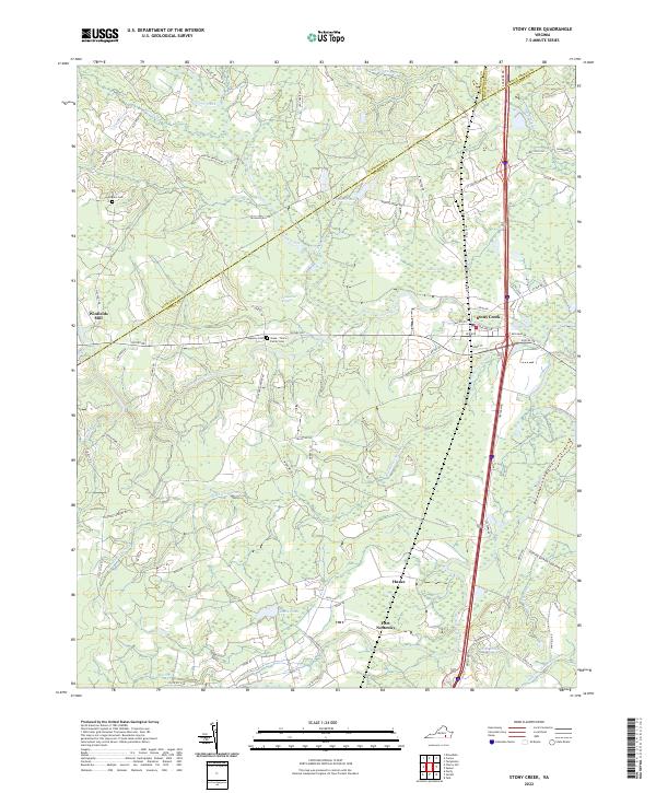
2022 Map of Stony Creek
USGS Topo · Published 2022About this map
The Nottoway River and its intricate network of tributaries define the landscape of this Sussex County region. The town of Stony Creek serves as a primary hub where roads like Halifax Rd and Red Bank Rd converge. Further south, the map reveals smaller settlements such as Huske and the curiously named Fort Nottoway. For those tracing local families, several burial grounds are documented, including the Pegram Cem near the northwestern corner and the Jones - Timms Family Cem situated along Sussex Dr.
Find a feature on this map
77 named features on this map. Tap any name to fly to it.
Don’t see what you’re looking for? This feature index may not catch every label — zoom into the map to look around manually.
Map Details
Editions of this 2022 Stony Creek Map
This is the sole edition of this map. No revisions or reprints were ever made.
Other maps of this area

1894 · Petersburg
USGS Topo · 1:62,500

1897 · Amelia
USGS Topo · 1:125,000

1919 · Jarratt
USGS Topo · 1:62,500

1919 · Mc Kenney
USGS Topo · 1:48,000

1921 · Mc Kenney
USGS Topo · 1:62,500

1943 · Mc Kenney
USGS Topo · 1:62,500

1943 · Dinwiddie
USGS Topo · 1:24,000

1943 · Richmond
USGS Topo · 1:250,000

1944 · Reams
USGS Topo · 1:31,680
1944 · Dinwiddie
USGS Topo · 1:31,680