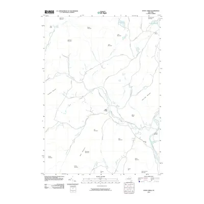
2010 Map of Stony Creek
USGS Topo · Published 2010About this map
The Stony Creek settlement serves as the central hub of this Adirondack region, where the eponymous Stony Creek watercourse winds through a landscape of named peaks and ridges. The waterway eventually meets the Hudson River at the eastern edge of the quadrangle, a critical confluence that historically shaped local movement and industry. The terrain is defined by prominent elevations such as Hadley Mountain, Deer Leap Mountain, and Gill Mountain, while smaller features like Holmes Hill and Walnut Ridge provide local landmarks for researchers and hikers.
Find a feature on this map
65 named features on this map. Tap any name to fly to it.
Don’t see what you’re looking for? This feature index may not catch every label — zoom into the map to look around manually.
Map Details
Editions of this 2010 Stony Creek Map
This is the sole edition of this map. No revisions or reprints were ever made.
Other maps of this area

1895 · North Creek
USGS Topo · 1:62,500

1897 · North Creek
USGS Topo · 1:62,500

1898 · Thirteenth Lake
USGS Topo · 1:62,500

1903 · Luzerne
USGS Topo · 1:62,500

1910 · Stony Creek
USGS Topo · 1:62,500

1950 · Glens Falls
USGS Topo · 1:250,000

1950 · Utica
USGS Topo · 1:250,000

1954 · Thirteenth Lake
USGS Topo · 1:62,500

1954 · Harrisburg
USGS Topo · 1:62,500
1955 · Lake Luzerne
USGS Topo · 1:62,500