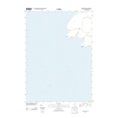
2013 Map of Stony Point
USGS Topo · Published 2013About this map
Stony Point Light House stands as a prominent maritime landmark on this coastal stretch of Lake Ontario in Jefferson County. The landscape is defined by the sharp protrusion of Stony Point and the nearby Clark Point, where the shoreline meets the expansive waters of the Great Lakes. The map reveals a network of local thoroughfares that hint at the area's historical and functional roots, including Military Rd and Windmill Rd. The residential and access patterns are clustered around the points, with names like Lighthouse Rd and Stony Point Ln indicating the significance of the light station to the local geography. This survey provides a clear view of the rural lakefront development and the strategic positioning of navigational aids along the New York coast during the early 21st century.
Find a feature on this map
15 named features on this map. Tap any name to fly to it.
Don’t see what you’re looking for? This feature index may not catch every label — zoom into the map to look around manually.
Map Details
Editions of this 2013 Stony Point Map
This is the sole edition of this map. No revisions or reprints were ever made.
Other maps of this area

1893 · Sackets Harbor
USGS Topo · 1:62,500

1895 · Sacketts Harbor
USGS Topo · 1:62,500

1895 · Stony Island
USGS Topo · 1:62,500

1895 · Pulaski
USGS Topo · 1:62,500

1942 · Stony Point
USGS Topo · 1:31,680

1942 · Henderson Bay
USGS Topo · 1:31,680

1942 · Galloo Island
USGS Topo · 1:31,680

1942 · Point Peninsula
USGS Topo · 1:31,680

1943 · Henderson
USGS Topo · 1:31,680
1943 · Ellisburg
USGS Topo · 1:31,680