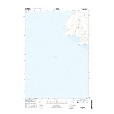
2016 Map of Stony Point
USGS Topo · Published 2016About this map
Stony Point and the eastern shores of Lake Ontario dominate this coastal survey of Jefferson County. The landscape is characterized by prominent headlands like Clark Point and sheltered inlets such as Sawyer Bay and Ray Bay. Coastal access is facilitated by a network of local thoroughfares including Lighthouse Rd and Military Rd, tracing the perimeter of the point. Just offshore, Calf Island sits at the northwestern edge of the map, marking the transition from the open lake to the rocky shoreline. The settlement pattern is largely defined by the geography of the water, with roads like Stony Point Ln and Windmill Rd serving the residential and recreational plots along Gravely Bay and Boomer Cove.
Find a feature on this map
17 named features on this map. Tap any name to fly to it.
Don’t see what you’re looking for? This feature index may not catch every label — zoom into the map to look around manually.
Map Details
Editions of this 2016 Stony Point Map
This is the sole edition of this map. No revisions or reprints were ever made.
Other maps of this area

1893 · Sackets Harbor
USGS Topo · 1:62,500

1895 · Sacketts Harbor
USGS Topo · 1:62,500

1895 · Stony Island
USGS Topo · 1:62,500

1895 · Pulaski
USGS Topo · 1:62,500

1942 · Stony Point
USGS Topo · 1:31,680

1942 · Henderson Bay
USGS Topo · 1:31,680

1942 · Galloo Island
USGS Topo · 1:31,680

1942 · Point Peninsula
USGS Topo · 1:31,680

1943 · Henderson
USGS Topo · 1:31,680
1943 · Ellisburg
USGS Topo · 1:31,680