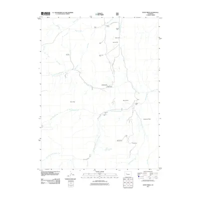
2011 Map of Stony Ridge
USGS Topo · Published 2011About this map
Mining operations and remote camps characterize this portion of Garfield County, where the industrial legacy of the Roaring Fork Valley area is etched into the landscape. Significant coal and mineral extraction sites are concentrated along the gulches, including the Union Mine, Spring Gulch Mine, and the dual operations at Thompson Creek Number One and Number Three. These workings follow the complex topography of Stony Ridge and Assignation Ridge, where steep drainages like Marion Gulch and Spring Gulch provide natural corridors for access and resource transport.
Find a feature on this map
34 named features on this map. Tap any name to fly to it.
Don’t see what you’re looking for? This feature index may not catch every label — zoom into the map to look around manually.
Map Details
Editions of this 2011 Stony Ridge Map
This is the sole edition of this map. No revisions or reprints were ever made.
Other maps of this area

1957 · Leadville
USGS Topo · 1:250,000

1959 · Leadville
USGS Topo · 1:250,000

1960 · Leadville
USGS Topo · 1:250,000

1960 · Redstone
USGS Topo · 1:24,000

1961 · Mount Sopris
USGS Topo · 1:24,000

1961 · Cattle Creek
USGS Topo · 1:24,000

1961 · Carbondale
USGS Topo · 1:24,000

1962 · Leadville
USGS Topo · 1:250,000
1963 · Center Mountain
USGS Topo · 1:24,000
1963 · Placita
USGS Topo · 1:24,000