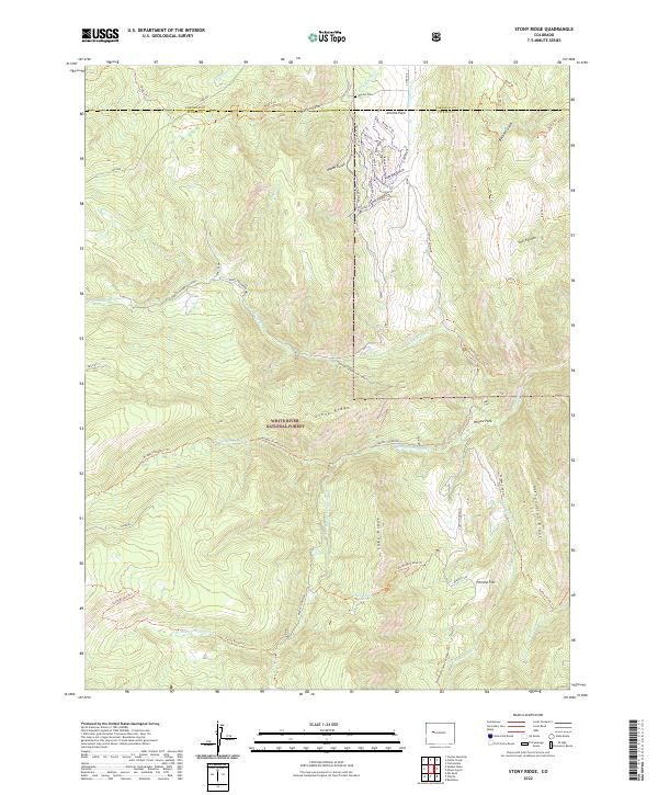
2022 Map of Stony Ridge
USGS Topo · Published 2022About this map
The high-elevation terrain along the border of Garfield and Pitkin counties is characterized by an intricate network of drainage systems and ridge lines within the White River National Forest. At the northern edge, Jerome Park and Marion Gulch provide evidence of early land use, including the Marion Cem. The landscape is dominated by the massive landforms of Stony Ridge, Lake Ridge, and Assignation Ridge, which divide the watersheds of North Thompson Creek and its southern branches.
Find a feature on this map
61 named features on this map. Tap any name to fly to it.
Don’t see what you’re looking for? This feature index may not catch every label — zoom into the map to look around manually.
Map Details
Editions of this 2022 Stony Ridge Map
This is the sole edition of this map. No revisions or reprints were ever made.
Other maps of this area

1957 · Leadville
USGS Topo · 1:250,000

1959 · Leadville
USGS Topo · 1:250,000

1960 · Leadville
USGS Topo · 1:250,000

1960 · Redstone
USGS Topo · 1:24,000

1961 · Mount Sopris
USGS Topo · 1:24,000

1961 · Cattle Creek
USGS Topo · 1:24,000

1961 · Carbondale
USGS Topo · 1:24,000

1962 · Leadville
USGS Topo · 1:250,000
1963 · Center Mountain
USGS Topo · 1:24,000
1963 · Placita
USGS Topo · 1:24,000