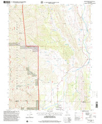
1996 Map of Stonyford
USGS Topo · Published 2001About this map
Stonyford sits at the edge of the Mendocino National Forest, where the complex topography of the Inner Coast Range meets the agricultural flats of Indian Valley. This 1990s revision of earlier surveys details a landscape defined by significant elevation changes and seasonal water sources. The transition from the high ridges of Brushy Ridge and Black Diamond Ridge down to the valley floor is marked by numerous prospects and specialized forest service infrastructure like the Grindstone Work Center.
Find a feature on this map
35 named features on this map. Tap any name to fly to it.
Don’t see what you’re looking for? This feature index may not catch every label — zoom into the map to look around manually.
Map Details
Editions of this 1996 Stonyford Map
This is the sole edition of this map. No revisions or reprints were ever made.
Other maps of this area

1919 · Fruto
USGS Topo · 1:62,500

1919 · Elk Creek
USGS Topo · 1:62,500

1943 · Lodoga
USGS Topo · 1:62,500

1944 · Fruto
USGS Topo · 1:62,500

1948 · Elk Creek
USGS Topo · 1:62,500

1951 · Stonyford
USGS Topo · 1:62,500

1957 · Elk Creek
USGS Topo · 1:62,500

1957 · Ukiah
USGS Topo · 1:250,000
1958 · Fruto
USGS Topo · 1:62,500

1960 · Ukiah
USGS Topo · 1:250,000