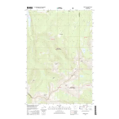
2017 Map of Storm Lake
USGS Topo · Published 2017About this map
The Continental Divide defines the spine of this high-elevation landscape, where the Deerlodge National Forest and Beaverhead National Forest meet. This 2017 survey shows a complex hydrological network centered around Storm Lake and the E Fork Reservoir, with numerous glacial lakes like Emerald Lake and Flower Lake tucked into the cirques. The terrain is marked by prominent peaks such as Rainbow Mtn and Kurt Peak, with high passes including Storm Lake Pass and Cutaway Pass providing passage through the range. Of particular interest to those studying land use and topography is the broad, high-elevation alpine plateau of Goat Flat and the precisely delineated grazing or timber tracts labeled PB 45 through PB 50. Drainage patterns are clearly visible through Elk Cr and Storm Lake Cr, while open areas like One Hundred Acre Meadow break the forested slopes.
Find a feature on this map
53 named features on this map. Tap any name to fly to it.
Don’t see what you’re looking for? This feature index may not catch every label — zoom into the map to look around manually.
Map Details
Editions of this 2017 Storm Lake Map
This is the sole edition of this map. No revisions or reprints were ever made.
Other maps of this area

1908 · Philipsburg
USGS Topo · 1:125,000

1947 · Butte
USGS Topo · 1:250,000

1955 · Dillon
USGS Topo · 1:250,000

1957 · Dillon
USGS Topo · 1:250,000

1958 · Butte
USGS Topo · 1:250,000

1958 · Dillon
USGS Topo · 1:250,000

1960 · Butte
USGS Topo · 1:250,000

1962 · Butte
USGS Topo · 1:250,000

1962 · Dillon
USGS Topo · 1:250,000

1962 · Lower Seymour Lake
USGS Topo · 1:24,000