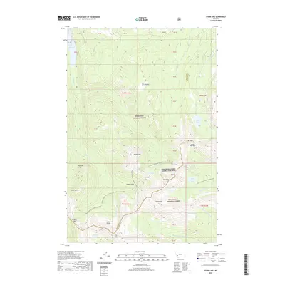
2020 Map of Storm Lake
USGS Topo · Published 2020About this map
The Anaconda Range high country defines this landscape, where the Continental Divide separates the Deerlodge National Forest and Beaverhead National Forest. This high-altitude terrain is marked by significant alpine water bodies, including Storm Lake and the East Fork Reservoir, which feed a complex network of drainages like Storm Lake Cr and the E Fork Rock Cr. The presence of the Continental Divide National Scenic Trail winding through the peaks highlights the region's importance for transit across the crest of the Rockies. For those studying the wilderness character of southwest Montana, the map reveals isolated basins and meadows such as One Hundred Acre Meadow and Queener Basin, alongside prominent summits like Rainbow Mtn and Kurt Peak that have long served as landmarks for mountain navigation.
Find a feature on this map
55 named features on this map. Tap any name to fly to it.
Don’t see what you’re looking for? This feature index may not catch every label — zoom into the map to look around manually.
Map Details
Editions of this 2020 Storm Lake Map
This is the sole edition of this map. No revisions or reprints were ever made.
Other maps of this area

1908 · Philipsburg
USGS Topo · 1:125,000

1947 · Butte
USGS Topo · 1:250,000

1955 · Dillon
USGS Topo · 1:250,000

1957 · Dillon
USGS Topo · 1:250,000

1958 · Butte
USGS Topo · 1:250,000

1958 · Dillon
USGS Topo · 1:250,000

1960 · Butte
USGS Topo · 1:250,000

1962 · Butte
USGS Topo · 1:250,000

1962 · Dillon
USGS Topo · 1:250,000

1962 · Lower Seymour Lake
USGS Topo · 1:24,000