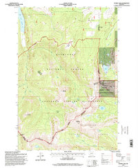
1996 Map of Storm Lake
USGS Topo · Published 1998About this map
Deerlodge National Forest and the Anaconda Pintler Wilderness dominate this high-elevation landscape, where the Continental Divide winds through the jagged peaks of southwestern Montana. The terrain is defined by glacial cirques and alpine lakes, including Storm Lake and the Upper Seymour Lake system. Evidence of mining history remains visible on the slopes, particularly near the Sunshine Mine and various Prospects scattered in the northeast.
Find a feature on this map
45 named features on this map. Tap any name to fly to it.
Don’t see what you’re looking for? This feature index may not catch every label — zoom into the map to look around manually.
Map Details
Editions of this 1996 Storm Lake Map
This is the sole edition of this map. No revisions or reprints were ever made.
Other maps of this area

1908 · Philipsburg
USGS Topo · 1:125,000

1947 · Butte
USGS Topo · 1:250,000

1955 · Dillon
USGS Topo · 1:250,000

1957 · Dillon
USGS Topo · 1:250,000

1958 · Butte
USGS Topo · 1:250,000

1958 · Dillon
USGS Topo · 1:250,000

1960 · Butte
USGS Topo · 1:250,000

1962 · Butte
USGS Topo · 1:250,000

1962 · Dillon
USGS Topo · 1:250,000

1962 · Lower Seymour Lake
USGS Topo · 1:24,000