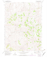
1968 Map of Stormy Peak
USGS Topo · Published 1983About this map
Stormy Peak anchors the southern reaches of the Snake Mountains in this high-altitude landscape of Elko County. The map reveals a land defined by water scarcity and resource extraction, with numerous unnamed Spring sites and clusters of Prospects scattered across the ridgelines. The drainage network is complex, featuring the upper headwaters of the North Fork Jakes Creek, Middle Fork Jakes Creek, and South Fork Jakes Creek as they flow eastward out of the mountain range.
Find a feature on this map
17 named features on this map. Tap any name to fly to it.
Don’t see what you’re looking for? This feature index may not catch every label — zoom into the map to look around manually.
Map Details
Editions of this 1968 Stormy Peak Map
2 editions found
Other maps of this area

1955 · Wells
USGS Topo · 1:250,000

1958 · Wells
USGS Topo · 1:250,000

1961 · Wells
USGS Topo · 1:250,000

1967 · Buena Vista Ranch
USGS Topo · 1:24,000

1967 · Black Butte NE
USGS Topo · 1:24,000

1968 · Hubbard Basin
USGS Topo · 1:24,000
1968 · Loomis Mtn
USGS Topo · 1:24,000

1968 · Hot Creek
USGS Topo · 1:24,000
1968 · Boies Reservoir
USGS Topo · 1:24,000
1968 · Stormy Peak
USGS Topo · 1:24,000