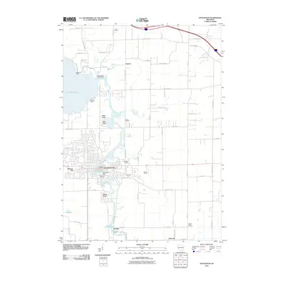
2010 Map of Stoughton
USGS Topo · Published 2010About this map
The Yahara River dictates the landscape and industry of this Dane County region, flowing south from Lake Kegonsa through the heart of Stoughton and down toward Dunkirk. The river's historical utility is evidenced by a series of water-control structures, including the Stoughton Dam and the Dunkirk Dam, which created substantial reservoirs like the Stoughton Millpond and Dunkirk Millpond. These sites hint at the milling history that once anchored these riverfront communities.
Find a feature on this map
63 named features on this map. Tap any name to fly to it.
Don’t see what you’re looking for? This feature index may not catch every label — zoom into the map to look around manually.
Map Details
Editions of this 2010 Stoughton Map
This is the sole edition of this map. No revisions or reprints were ever made.
Other maps of this area

1889 · Evansville
USGS Topo · 1:62,500

1890 · Madison
USGS Topo · 1:62,500

1890 · Sun Prairie
USGS Topo · 1:62,500

1890 · Stoughton
USGS Topo · 1:62,500

1892 · Madison
USGS Topo · 1:62,500

1894 · Evansville
USGS Topo · 1:62,500

1896 · Sun Prairie
USGS Topo · 1:62,500

1904 · Madison
USGS Topo · 1:62,500

1905 · Sun Prairie
USGS Topo · 1:62,500

1906 · Evansville
USGS Topo · 1:62,500