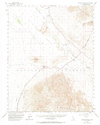
1952 Map of Stovepipe Wells
USGS Topo · Published 1969About this map
Death Valley dominates this 1952 topographic study, where the extreme topography of Tucki Mountain and the Grapevine Mountains frames the low-lying Mesquite Flat. At the center of this desert basin, Stovepipe Wells and the Stovepipe Wells Hotel serve as primary hubs for the Death Valley National Monument, supported by a landing strip and a network of unimproved desert roads. The map documents vital water sources in an arid landscape, including Triangle Spring, Midway Well, and the mineral-heavy waters of Salt Creek. A notable cultural feature is the Devils Cornfield, a distinctive area of arrowweed clumps, and the Old Toll Road which traces a path across the alluvial fans. This survey captures the mid-century infrastructure of the park before extensive modern paving, showing the original relationship between these desert outposts and the surrounding Sand Dunes.
Find a feature on this map
21 named features on this map. Tap any name to fly to it.
Don’t see what you’re looking for? This feature index may not catch every label — zoom into the map to look around manually.
Map Details
Editions of this 1952 Stovepipe Wells Map
4 editions found
Other maps of this area

1908 · Furnace Creek
USGS Topo · 1:250,000

1908 · Ballarat
USGS Topo · 1:250,000

1910 · Furnace Creek
USGS Topo · 1:250,000

1913 · Ballarat
USGS Topo · 1:250,000

1942 · Bullfrog
USGS Topo · 1:125,000

1948 · Death Valley
USGS Topo · 1:250,000

1951 · Panamint Butte
USGS Topo · 1:62,500

1951 · Marble Canyon
USGS Topo · 1:62,500

1952 · Chloride Cliff
USGS Topo · 1:50,000

1952 · Stovepipe Wells
USGS Topo · 1:62,500