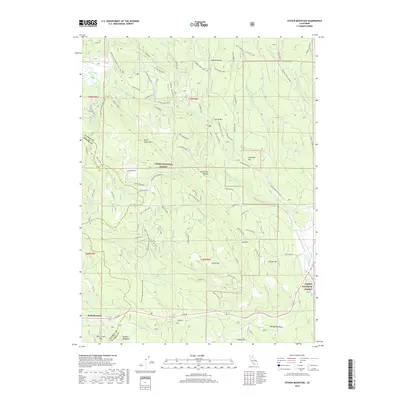
2018 Map of Stover Mountain
USGS Topo · Published 2018About this map
Saint Bernard sits at the southern edge of this landscape, where the high mountain terrain of the Lassen National Forest begins to dominate the horizon. This 2018 survey documents a region defined by recreational history and rugged infrastructure, most notably the winding path of the Pacific Crest National Scenic Trail as it traverses the western ridges. Evidence of past winter sports is found at Ski Hill and Old Ski Hill, while the local hydrology is shaped by the N Fork Feather River and numerous springs like Domingo Spring and Stover Spring. The map captures a complex network of forest roads and loops, including the Warner Valley Rd (SH 168), that provide access to high-elevation meadows such as Soldier Meadows and Moody Meadows.
Find a feature on this map
80 named features on this map. Tap any name to fly to it.
Don’t see what you’re looking for? This feature index may not catch every label — zoom into the map to look around manually.
Map Details
Editions of this 2018 Stover Mountain Map
This is the sole edition of this map. No revisions or reprints were ever made.
Other maps of this area

1886 · Lassen Peak
USGS Topo · 1:250,000

1892 · Lassen Peak
USGS Topo · 1:250,000

1894 · Lassen Peak
USGS Topo · 1:250,000

1955 · Almanor
USGS Topo · 1:62,500

1955 · Westwood
USGS Topo · 1:250,000

1956 · Mt. Harkness
USGS Topo · 1:62,500

1956 · Chester
USGS Topo · 1:62,500

1958 · Westwood
USGS Topo · 1:250,000

1958 · Jonesville
USGS Topo · 1:62,500

1959 · Westwood
USGS Topo · 1:250,000