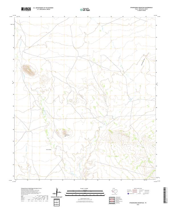
2022 Map of Straddlebug Mountain
USGS Topo · Published 2022About this map
Green Valley dominates this arid landscape in Brewster County, defined by a network of seasonal drainage patterns that shape the local geography. The topography is anchored by the prominent Straddlebug Mtn, standing as a central landmark above the desert floor. Water, though often ephemeral, dictates the layout of the land, with Terlingua Cr and Musgrave Cr carving paths through the valley. This 2022 survey illustrates the sparse, ranch-oriented infrastructure characteristic of the Big Bend region, where named drainage features like The Ditch and Butcherknife Draw serve as critical markers in a territory with few permanent settlements. The map's contour lines reveal the complex elevation changes that define the transition from flat valley floors to isolated peaks.
Find a feature on this map
6 named features on this map. Tap any name to fly to it.
Don’t see what you’re looking for? This feature index may not catch every label — zoom into the map to look around manually.
Map Details
Editions of this 2022 Straddlebug Mountain Map
This is the sole edition of this map. No revisions or reprints were ever made.
Other maps of this area

1917 · Agua Fria
USGS Topo · 1:62,500

1917 · Tascotal Mesa
USGS Topo · 1:62,500

1917 · Buck Hill
USGS Topo · 1:62,500

1918 · Buck Hill
USGS Topo · 1:62,500

1918 · Jordan Gap
USGS Topo · 1:62,500

1925 · Buck Hill
USGS Topo · 1:62,500

1930 · Jordan Gap
USGS Topo · 1:62,500

1937 · Agua Fria
USGS Topo · 1:62,500

1944 · Tascotal Mesa
USGS Topo · 1:62,500

1959 · Emory Peak
USGS Topo · 1:250,000