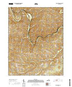
2019 Map of Straightstone
USGS Topo · Published 2019About this map
The Roanoke River carves a deep, winding path through the borderlands of Campbell and Pittsylvania counties, defining the character of this central Virginia landscape. Small rural communities like Straightstone and Level Run anchor the southern portion of the sheet, connected by a network of winding county roads such as Level Run Rd. To the northwest, the Mansion Truss Bridge spans the water near the settlement of Hodges, providing a critical crossing point for the local agricultural economy. Genealogists and local historians will find points of interest at the New Bethel Cem near Grit, while the terrain is dominated by features like Brown Mtn and the various tributaries feeding into the main river valley, including Beechtree Cr and Little Straightstone Cr. The map captures a region where development remains secondary to the natural drainage patterns of the Virginia piedmont.
Find a feature on this map
67 named features on this map. Tap any name to fly to it.
Don’t see what you’re looking for? This feature index may not catch every label — zoom into the map to look around manually.
Map Details
Editions of this 2019 Straightstone Map
This is the sole edition of this map. No revisions or reprints were ever made.
Other maps of this area

1892 · Lynchburg
USGS Topo · 1:125,000

1921 · Chatham
USGS Topo · 1:48,000

1923 · Chatham
USGS Topo · 1:62,500

1947 · Roanoke
USGS Topo · 1:250,000

1951 · Altavista
USGS Topo · 1:62,500

1953 · Greensboro
USGS Topo · 1:250,000

1954 · Greensboro
USGS Topo · 1:250,000

1954 · Riceville
USGS Topo · 1:62,500

1956 · Gladys
USGS Topo · 1:62,500

1959 · Roanoke
USGS Topo · 1:250,000