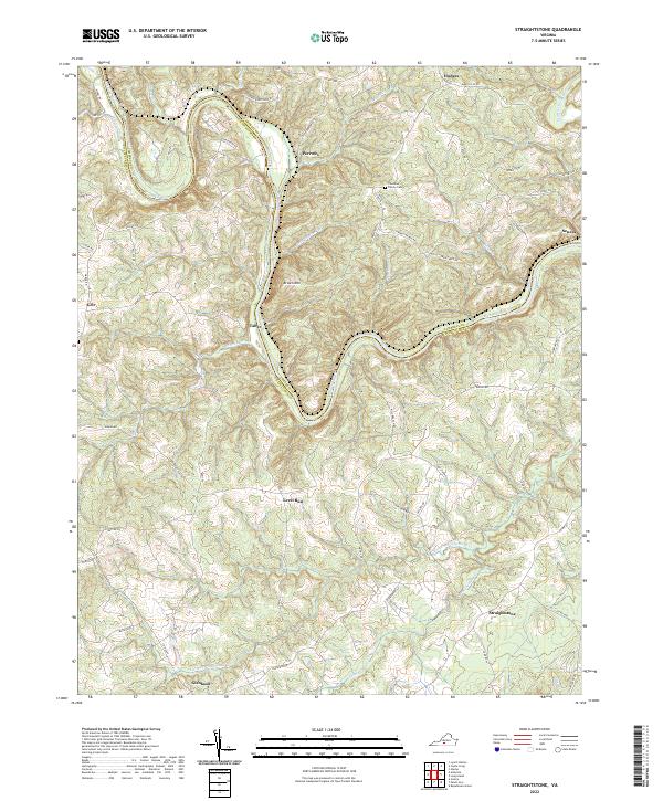
2022 Map of Straightstone
USGS Topo · Published 2022About this map
The Roanoke River winds through this rural landscape on the border of Campbell and Pittsylvania counties, defining a topography of sharp bends and ridges. At the northern horseshoe bend, Perrows sits near the river's edge, while Brown Mtn rises to the south, commanding the center of the sheet. The settlement pattern is dispersed, with small communities such as Straightstone and Level Run connected by a network of local roads that trace the undulating terrain of the Piedmont region.
Find a feature on this map
11 named features on this map. Tap any name to fly to it.
Don’t see what you’re looking for? This feature index may not catch every label — zoom into the map to look around manually.
Map Details
Editions of this 2022 Straightstone Map
This is the sole edition of this map. No revisions or reprints were ever made.
Other maps of this area

1892 · Lynchburg
USGS Topo · 1:125,000

1921 · Chatham
USGS Topo · 1:48,000

1923 · Chatham
USGS Topo · 1:62,500

1947 · Roanoke
USGS Topo · 1:250,000

1951 · Altavista
USGS Topo · 1:62,500

1953 · Greensboro
USGS Topo · 1:250,000

1954 · Greensboro
USGS Topo · 1:250,000

1954 · Riceville
USGS Topo · 1:62,500

1956 · Gladys
USGS Topo · 1:62,500

1959 · Roanoke
USGS Topo · 1:250,000