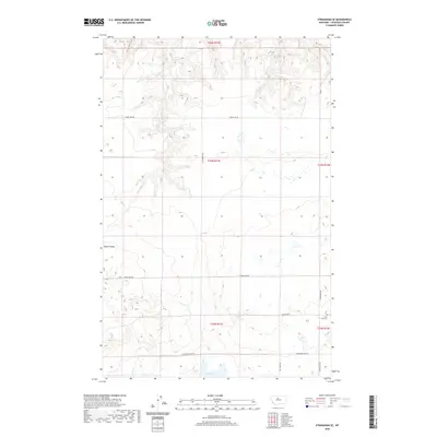
2020 Map of Stranahan SE
USGS Topo · Published 2020About this map
Clear Lake Cem stands as a primary point of historical interest in this corner of Chouteau County, serving as a quiet marker of the community that established itself near the shores of Clear Lake. This landscape is defined by the high plains of central Montana, where the terrain is punctuated by the deep cut of Rowe Coulee. The survey reveals a structured grid of rural transit, with thoroughfares like Clear Lake Rd, Enterprise Rd, and Hardwood Lake Rd connecting the scattered homesteads and agricultural tracts. The layout of these roads, including the uniquely named Ric Oshay Rd, reflects the enduring Public Land Survey System that carved the region into precise townships and sections, a framework that continues to dictate the local geography today.
Find a feature on this map
15 named features on this map. Tap any name to fly to it.
Don’t see what you’re looking for? This feature index may not catch every label — zoom into the map to look around manually.
Map Details
Editions of this 2020 Stranahan SE Map
This is the sole edition of this map. No revisions or reprints were ever made.
Other maps of this area

1890 · Fort Benton
USGS Topo · 1:250,000

1892 · Fort Benton
USGS Topo · 1:250,000

1897 · Fort Benton
USGS Topo · 1:250,000

1953 · Rocky Lake
USGS Topo · 1:24,000

1953 · Loma East
USGS Topo · 1:24,000

1953 · Big Bend School
USGS Topo · 1:24,000

1953 · Stranahan
USGS Topo · 1:24,000

1954 · Great Falls
USGS Topo · 1:250,000

1957 · Great Falls
USGS Topo · 1:250,000
1972 · Eagle Buttes SW
USGS Topo · 1:24,000