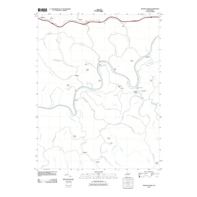
2010 Map of Strange Creek
USGS Topo · Published 2010About this map
The Elk River winds through central West Virginia in this 2010 survey, carving a deep path through the highlands between Duck and the settlement of Strange Creek. This area of Clay County is defined by its numerous family and community burial grounds, including the Eagle Cemetery, Murphy Cemetery, and Duffield Cemetery, which provide essential points of reference for genealogists tracing local lineage. The topography is shaped by sharp rises such as Snake Knob and Bragg Knob, while a dense network of water bodies like Big Otter Creek and Birch River feed into the central river system.
Find a feature on this map
83 named features on this map. Tap any name to fly to it.
Don’t see what you’re looking for? This feature index may not catch every label — zoom into the map to look around manually.
Map Details
Editions of this 2010 Strange Creek Map
This is the sole edition of this map. No revisions or reprints were ever made.
Other maps of this area

1889 · Nicholas
USGS Topo · 1:125,000

1891 · Nicholas
USGS Topo · 1:125,000

1893 · Sutton
USGS Topo · 1:125,000

1897 · Kanawha Falls
USGS Topo · 1:125,000

1900 · Kanawha Falls
USGS Topo · 1:125,000

1901 · Nicholas
USGS Topo · 1:125,000

1901 · Kanawha Falls
USGS Topo · 1:125,000

1906 · Otter
USGS Topo · 1:62,500

1907 · Otter
USGS Topo · 1:62,500

1908 · Clay
USGS Topo · 1:48,000