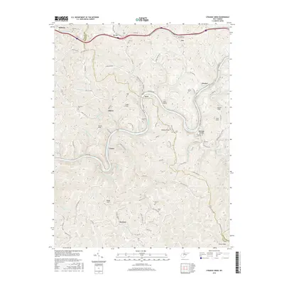
2016 Map of Strange Creek
USGS Topo · Published 2016About this map
The Elk River winds through a deeply incised landscape in this 2016 survey of central West Virginia, where the borders of Clay, Braxton, and Nicholas Counties converge. Small communities like Duck, Groves, and Strange Creek anchor the narrow valleys, connected by a network of rural routes such as the Groves-Wattsville road and the Servia-Elmira Rd. The map illustrates the region's complex hydrology, featuring numerous named drainages like Twisting Chute Cr and Waters Defeat that flow toward the main river channel.
Find a feature on this map
101 named features on this map. Tap any name to fly to it.
Don’t see what you’re looking for? This feature index may not catch every label — zoom into the map to look around manually.
Map Details
Editions of this 2016 Strange Creek Map
This is the sole edition of this map. No revisions or reprints were ever made.
Other maps of this area

1889 · Nicholas
USGS Topo · 1:125,000

1891 · Nicholas
USGS Topo · 1:125,000

1893 · Sutton
USGS Topo · 1:125,000

1897 · Kanawha Falls
USGS Topo · 1:125,000

1900 · Kanawha Falls
USGS Topo · 1:125,000

1901 · Nicholas
USGS Topo · 1:125,000

1901 · Kanawha Falls
USGS Topo · 1:125,000

1906 · Otter
USGS Topo · 1:62,500

1907 · Otter
USGS Topo · 1:62,500

1908 · Clay
USGS Topo · 1:48,000