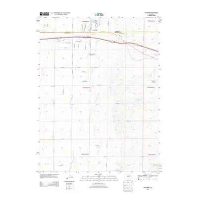
2013 Map of Strasburg
USGS Topo · Published 2013About this map
Strasburg serves as the primary hub in this eastern Colorado landscape, situated along the border of Adams Co and Arapahoe Co. The 2013 survey illustrates a region defined by agricultural heritage and a unique density of private aviation facilities, including Comanche Airfield, Comanche Springs Ranch Airport, and Spickard Farm Airport. These airfields are interspersed among a network of seasonal watercourses such as Wolf Cr, Comanche Cr, and Little Comanche Cr. The layout of local infrastructure, from the residential streets of Strasburg like Comanche Cir and Asoka St to the rural extensions of N Co Highway 157 and Co Road 149, reveals the area's transition from traditional ranching toward modern rural residential development. Notable water management features like the Rock Canyon Erosion Control Reservoir Number 2 and Spring Gulch highlight the environmental engineering required to manage the High Plains drainage systems.
Find a feature on this map
58 named features on this map. Tap any name to fly to it.
Don’t see what you’re looking for? This feature index may not catch every label — zoom into the map to look around manually.
Map Details
Editions of this 2013 Strasburg Map
This is the sole edition of this map. No revisions or reprints were ever made.
Other maps of this area

1949 · Bennett
USGS Topo · 1:24,000

1950 · Roper School
USGS Topo · 1:24,000

1951 · Roper School
USGS Topo · 1:24,000

1952 · Leader SW
USGS Topo · 1:24,000

1953 · Denver
USGS Topo · 1:250,000

1955 · Strasburg NW
USGS Topo · 1:24,000

1955 · Strasburg
USGS Topo · 1:24,000

1956 · Byers
USGS Topo · 1:24,000

1957 · Denver
USGS Topo · 1:250,000

1958 · Denver
USGS Topo · 1:250,000