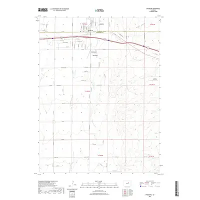
2019 Map of Strasburg
USGS Topo · Published 2019About this map
Strasburg serves as the central hub of this eastern plains landscape, straddling the county line between Adams Co and Arapahoe Co. The settlement's grid is defined by streets like Wagner St and Strasburg Rd, transitioning quickly into a sprawling agricultural and aviation-focused corridor. The prevalence of small-scale aviation is notable, with three distinct facilities—Comanche Airfield LLC, Comanche Springs Ranch Airport, and Spickard Farm Airport—dotted across the terrain. These sites reflect the region's reliance on private flight for ranching and commerce in the open country east of the metropolitan center.
Find a feature on this map
76 named features on this map. Tap any name to fly to it.
Don’t see what you’re looking for? This feature index may not catch every label — zoom into the map to look around manually.
Map Details
Editions of this 2019 Strasburg Map
This is the sole edition of this map. No revisions or reprints were ever made.
Other maps of this area

1949 · Bennett
USGS Topo · 1:24,000

1950 · Roper School
USGS Topo · 1:24,000

1951 · Roper School
USGS Topo · 1:24,000

1952 · Leader SW
USGS Topo · 1:24,000

1953 · Denver
USGS Topo · 1:250,000

1955 · Strasburg NW
USGS Topo · 1:24,000

1955 · Strasburg
USGS Topo · 1:24,000

1956 · Byers
USGS Topo · 1:24,000

1957 · Denver
USGS Topo · 1:250,000

1958 · Denver
USGS Topo · 1:250,000