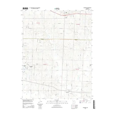
2014 Map of Strasburg
USGS Topo · Published 2014About this map
Strasburg and the eastern edge of Pleasant Hill anchor this rural landscape along the Cass and Jackson County line. The terrain is defined by the branching tributaries of the Big Creek watershed, including the West Branch and East Branch of Crawford Creek. While modern infrastructure like Us-50 cuts through the northern portion near Lone Jack, the area maintains its local character through longstanding landmarks like Soldiers Cemetery and Sloan Cemetery.
Find a feature on this map
86 named features on this map. Tap any name to fly to it.
Don’t see what you’re looking for? This feature index may not catch every label — zoom into the map to look around manually.
Map Details
Editions of this 2014 Strasburg Map
This is the sole edition of this map. No revisions or reprints were ever made.
Other maps of this area

1887 · Harrisonville
USGS Topo · 1:125,000

1892 · Harrisonville
USGS Topo · 1:125,000

1894 · Harrisonville
USGS Topo · 1:125,000

1934 · Woods Chapel
USGS Topo · 1:24,000

1935 · Tarsney
USGS Topo · 1:24,000

1947 · Lawrence
USGS Topo · 1:250,000

1950 · Lawrence
USGS Topo · 1:250,000

1954 · Harrisonville
USGS Topo · 1:24,000
1954 · East Lynne
USGS Topo · 1:24,000
1954 · Kingsville
USGS Topo · 1:24,000