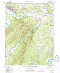
1966 Map of Strasburg
USGS Topo · Published 1987About this map
The North Fork Shenandoah River winds sharply through this mid-1960s survey of the northern Shenandoah Valley. The town of Strasburg dominates the northwest corner, serving as a hub where the Southern Railway corridor meets the river’s edge near River View Cem. To the south, the landscape rises dramatically into the Massanutten Mountain range, part of the George Washington National Forest. This mountainous area is defined by sharp ridges like Signal Knob and deep valleys carved by Passage Creek.
Find a feature on this map
53 named features on this map. Tap any name to fly to it.
Don’t see what you’re looking for? This feature index may not catch every label — zoom into the map to look around manually.
Map Details
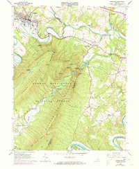
Editions of this 1966 Strasburg Map
2 editions found
Other maps of this area

1893 · Luray
USGS Topo · 1:125,000

1894 · Winchester
USGS Topo · 1:125,000

1905 · Luray
USGS Topo · 1:125,000

1923 · Middletown
USGS Topo · 1:62,500

1937 · Middletown
USGS Topo · 1:48,000

1938 · Winchester
USGS Topo · 1:48,000

1939 · Front Royal
USGS Topo · 1:48,000

1942 · Winchester
USGS Topo · 1:62,500

1943 · Middletown
USGS Topo · 1:62,500

1944 · Front Royal
USGS Topo · 1:62,500