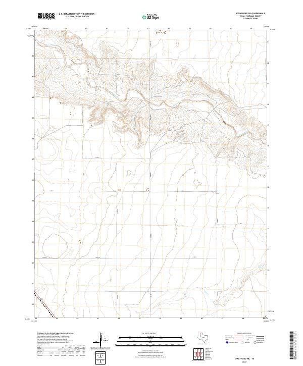
2022 Map of Stratford NE
USGS Topo · Published 2022About this map
The Beaver River winds through the northern portion of this Sherman County landscape, carving a distinct drainage pattern into the high plains terrain. This 2022 survey captures the area's rural character, dominated by a strict grid of county roads and large-scale agricultural parcels. In the southeastern corner, Frisco Cr provides a secondary drainage, contrasting with the more pronounced valley of the main river to the north. A network of arterial routes including Beaver Rd, Co Rd H, and Co Rd E connect the isolated ranching and farming operations typical of the Texas Panhandle. The map also records a segment of Route 287 clipping the southwest corner, representing the primary regional transit corridor through this open country.
Find a feature on this map
11 named features on this map. Tap any name to fly to it.
Don’t see what you’re looking for? This feature index may not catch every label — zoom into the map to look around manually.
Map Details
Editions of this 2022 Stratford NE Map
This is the sole edition of this map. No revisions or reprints were ever made.
Other maps of this area

1954 · Perryton
USGS Topo · 1:250,000

1954 · Dalhart
USGS Topo · 1:250,000

1958 · Perryton
USGS Topo · 1:250,000

1958 · Dalhart
USGS Topo · 1:250,000

1962 · Dalhart
USGS Topo · 1:250,000

1964 · Brickel
USGS Topo · 1:24,000

1964 · Kerrick
USGS Topo · 1:24,000

1964 · Stevens SW
USGS Topo · 1:24,000

1964 · Stratford
USGS Topo · 1:24,000

1964 · Stratford NE
USGS Topo · 1:24,000