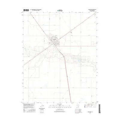
2016 Map of Stratford
USGS Topo · Published 2016About this map
Stratford serves as the focal point of this Sherman County panhandle survey, appearing as a concentrated grid of streets amidst a landscape of high plains agriculture and drainage basins. The town's layout is meticulously detailed, showing the intersection of local thoroughfares like Purnell Ave and S Main St alongside specific residential and commercial divisions. To the northwest and southeast, the ephemeral paths of Frisco Creek and Coldwater Creek reveal the natural topography that dictates the regional water flow. A notable piece of local infrastructure, the Stratford Feeders Reservoir, is situated along the Coldwater drainage, illustrating the critical role of water management in this cattle-and-grain economy. The map also identifies local landmarks essential for genealogical research and community history, including the Stratford Cem and Stratford Field.
Find a feature on this map
42 named features on this map. Tap any name to fly to it.
Don’t see what you’re looking for? This feature index may not catch every label — zoom into the map to look around manually.
Map Details
Editions of this 2016 Stratford Map
This is the sole edition of this map. No revisions or reprints were ever made.
Other maps of this area

1954 · Perryton
USGS Topo · 1:250,000

1954 · Dalhart
USGS Topo · 1:250,000

1958 · Perryton
USGS Topo · 1:250,000

1958 · Dalhart
USGS Topo · 1:250,000

1962 · Dalhart
USGS Topo · 1:250,000

1964 · Brickel
USGS Topo · 1:24,000

1964 · Kerrick
USGS Topo · 1:24,000

1964 · Stevens SW
USGS Topo · 1:24,000

1964 · Stratford
USGS Topo · 1:24,000

1964 · Stratford NE
USGS Topo · 1:24,000