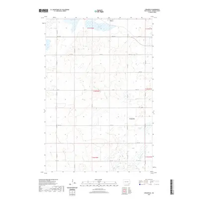
2020 Map of Straubville
USGS Topo · Published 2020About this map
Straubville serves as the primary focal point of this Sargent County survey, situated in a landscape characterized by the intricate water systems of the Prairie Pothole Region. The northern edge is dominated by Lake Taayer and Pickell Slough, while Meszaros Slough lies to the southeast of the settlement. These natural water bodies are supplemented by man-made drainage efforts, including Ditch Number 1 in the southern portion of the quadrangle. For genealogists and local historians, the Scandinavian Hilltop Cem located in the north provides a significant landmark of early community settlement. The township is organized by a precise grid of section-line roads, such as 90th St SE and Co Rd 3, which reflect the enduring agricultural land division patterns of North Dakota.
Find a feature on this map
20 named features on this map. Tap any name to fly to it.
Don’t see what you’re looking for? This feature index may not catch every label — zoom into the map to look around manually.
Map Details
Editions of this 2020 Straubville Map
This is the sole edition of this map. No revisions or reprints were ever made.
Other maps of this area

1894 · Hecla
USGS Topo · 1:62,500

1894 · Oakes
USGS Topo · 1:62,500

1895 · Lamoure
USGS Topo · 1:125,000

1896 · Columbia
USGS Topo · 1:125,000

1918 · La Moure
USGS Topo · 1:125,000

1952 · Oakes
USGS Topo · 1:24,000

1952 · Crete
USGS Topo · 1:24,000

1953 · Jamestown
USGS Topo · 1:250,000

1953 · Newark
USGS Topo · 1:24,000

1953 · Milbank
USGS Topo · 1:250,000
Featured Places
- Brampton Township, ND
- Jackson Township, ND
- Southwest Township, ND
- Verner Township, ND
- Harlem Township, ND