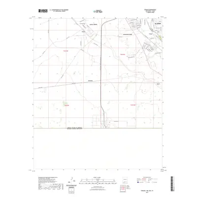
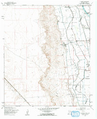
2023 Map of Strauss
USGS Topo · Published 2023About this map
The United States of America Estados Unidos Mexicanos border defines the southern extent of this desert landscape where New Mexico meets Texas. The area transitions from the arid, open terrain around the small settlement of Strauss and the Mastodon rail point to the more densely developed residential and commercial corridors of Santa Teresa and Sunland Park. This borderland geography is shaped by international logistics, evidenced by the Santa Teresa International Beltway and proximity to the Mesilla Valley. In the northeast corner, the drainage systems of the Crawford Lateral and West Drain indicate the shift toward the irrigated agricultural lands of the valley floor, while the communities of Orange and El Paso sit at the edge of the state boundary. Local infrastructure such as Strauss Rd and McNutt Rd connect these outlying desert reaches to the metropolitan fringe.
Find a feature on this map
52 named features on this map. Tap any name to fly to it.
Don’t see what you’re looking for? This feature index may not catch every label — zoom into the map to look around manually.
Map Details
Editions of this 2023 Strauss Map
This is the sole edition of this map. No revisions or reprints were ever made.
Other maps of this area

1917 · Canutillo
USGS Topo · 1:62,500

1917 · Noria
USGS Topo · 1:62,500

1918 · Noria
USGS Topo · 1:62,500

1919 · Canutillo
USGS Topo · 1:62,500

1953 · El Paso
USGS Topo · 1:250,000
1955 · Smeltertown
USGS Topo · 1:24,000
1955 · Strauss
USGS Topo · 1:24,000
1955 · Canutillo
USGS Topo · 1:24,000
1955 · La Union
USGS Topo · 1:24,000

1959 · El Paso
USGS Topo · 1:250,000