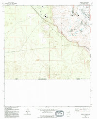
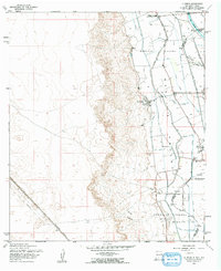
1994 Map of Strauss
USGS Topo · Published 1994About this map
The international boundary between the United States of America Estados Unidos Mexicanos anchors this 1990s revision of the borderlands south of Strauss. This desert landscape is defined by the transition from the arid uplands down into the fertile Mesilla Valley, where water management infrastructure like the Crawford Lateral and West Drain supports agricultural activity. Near the state line between New Mexico and Texas, the map shows the development of the Dona Ana County at Santa Teresa Airport and nearby educational facilities like Santa Teresa Jr High Sch. Transportation history is layered here, with the active Southern Pacific line running parallel to an Old Railroad Grade. Small settlements and landmarks, including Mastodon and various wells, are scattered across the terrain, illustrating the sparse but deliberate footprint of human activity in this corner of Doña Ana County.
Find a feature on this map
22 named features on this map. Tap any name to fly to it.
Don’t see what you’re looking for? This feature index may not catch every label — zoom into the map to look around manually.
Map Details
Editions of this 1994 Strauss Map
This is the sole edition of this map. No revisions or reprints were ever made.
Other maps of this area

1917 · Canutillo
USGS Topo · 1:62,500

1917 · Noria
USGS Topo · 1:62,500

1918 · Noria
USGS Topo · 1:62,500

1919 · Canutillo
USGS Topo · 1:62,500

1953 · El Paso
USGS Topo · 1:250,000
1955 · Smeltertown
USGS Topo · 1:24,000
1955 · Strauss
USGS Topo · 1:24,000
1955 · Canutillo
USGS Topo · 1:24,000
1955 · La Union
USGS Topo · 1:24,000

1959 · El Paso
USGS Topo · 1:250,000