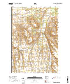
2020 Map of Strawberry Canyon NE
USGS Topo · Published 2020About this map
Finley Buttes serves as a central topographical landmark in this portion of Morrow County, where the landscape is defined by the broad drainage of Sand Hollow. The map reveals a highly structured grid of land management and transportation, characteristic of Oregon’s high desert agricultural and rangeland regions. Long, straight thoroughfares like Bombing Range Rd and Poleline Rd indicate modern infrastructure and resource management, while the presence of Lindsay Feedlot Ln points to the area's continued role in the regional livestock industry. The inclusion of Wagon Trail Rd in the southeastern corner offers a tangible connection to historical transit corridors that preceded the formal county road system, contrasting with the strictly surveyed lines of Homestead Ln and Alpine Ln.
Find a feature on this map
11 named features on this map. Tap any name to fly to it.
Don’t see what you’re looking for? This feature index may not catch every label — zoom into the map to look around manually.
Map Details
Editions of this 2020 Strawberry Canyon NE Map
This is the sole edition of this map. No revisions or reprints were ever made.
Other maps of this area

1906 · Blalock Island
USGS Topo · 1:125,000

1908 · Blalock Island
USGS Topo · 1:125,000

1908 · Umatilla
USGS Topo · 1:125,000

1953 · Pendleton
USGS Topo · 1:250,000

1956 · Pendleton
USGS Topo · 1:250,000

1962 · Ordnance
USGS Topo · 1:24,000

1962 · Boardman
USGS Topo · 1:24,000

1962 · Clarke
USGS Topo · 1:24,000

1968 · Service Buttes NW
USGS Topo · 1:24,000

1968 · Butter Creek Junction
USGS Topo · 1:24,000