
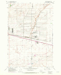
1962 Map of Ordnance
USGS Topo · Published 1963About this map
The Umatilla Ordnance Depot dominates this portion of the high desert along the border of Morrow and Umatilla counties. This mid-century landscape is defined by the rigid grid of military infrastructure and the vital systems of water management necessary for life in the Columbia Basin. The presence of the West Extension Irrigation Canal and the High Line Canal, alongside numerous labeled wells such as Well 555 and Well 582, illustrates the intensive effort to reclaim this arid terrain for use.
Find a feature on this map
24 named features on this map. Tap any name to fly to it.
Don’t see what you’re looking for? This feature index may not catch every label — zoom into the map to look around manually.
Map Details
Editions of this 1962 Ordnance Map
2 editions found
Other maps of this area

1906 · Blalock Island
USGS Topo · 1:125,000

1908 · Blalock Island
USGS Topo · 1:125,000

1908 · Umatilla
USGS Topo · 1:125,000

1953 · Pendleton
USGS Topo · 1:250,000

1956 · Pendleton
USGS Topo · 1:250,000

1962 · Paterson
USGS Topo · 1:24,000

1962 · Hermiston
USGS Topo · 1:24,000

1962 · Clarke
USGS Topo · 1:24,000
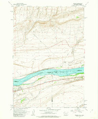
1962 · Irrigon
USGS Topo · 1:24,000

1962 · Umatilla
USGS Topo · 1:24,000