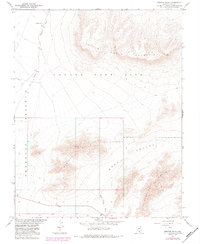
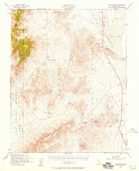
1961 Map of Striped Hills
USGS Topo · Published 1984About this map
Nevada Test Site lands dominate the northern half of this topographic study, where the arid basin and range topography meets restricted federal territory. The landscape is defined by the massive elevation of Little Skull Mountain and the distinctively eroded Striped Hills to the south. This area, mapped in cooperation with the Atomic Energy Commission, shows a terrain shaped by dry drainage systems including Topopah Wash and Rock Valley Wash. Notable infrastructure within the high-desert environment includes a remote Weather Station and a Tunnel situated among the ridges. The survey captures the transition from the broad Amargosa Valley and Cane Desert into the rugged peaks of the Specter Range, reflecting the mid-century intersection of military testing grounds and the Nevada wilderness.
Find a feature on this map
14 named features on this map. Tap any name to fly to it.
Don’t see what you’re looking for? This feature index may not catch every label — zoom into the map to look around manually.
Map Details
Editions of this 1961 Striped Hills Map
4 editions found
Other maps of this area

1908 · Furnace Creek
USGS Topo · 1:250,000

1910 · Furnace Creek
USGS Topo · 1:250,000

1942 · Skull Mountain
USGS Topo · 1:125,000

1948 · Death Valley
USGS Topo · 1:250,000

1952 · Topopah Spring
USGS Topo · 1:62,500

1952 · Specter Range
USGS Topo · 1:62,500
1952 · Cane Spring
USGS Topo · 1:62,500

1954 · Death Valley
USGS Topo · 1:250,000

1956 · Death Valley
USGS Topo · 1:250,000

1957 · Death Valley
USGS Topo · 1:250,000