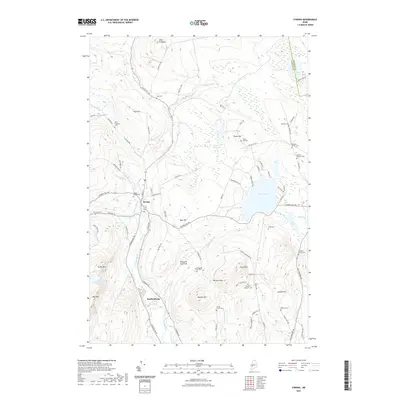
2021 Map of Strong
USGS Topo · Published 2021About this map
The Sandy River valley serves as the primary corridor for settlement in this part of Franklin County, where the village of Strong sits at the confluence with Valley Brook. This landscape is defined by its transition from fertile river bottoms like Hartwell Intervale to the prominent peaks of Day Mtn and Hunter Mtn. The distribution of dozens of family-named cemeteries, such as the Hunter French Cem and Cunningham Cates Cem, suggests a long history of small-scale hill farming and localized hamlets that once populated the surrounding ridges.
Find a feature on this map
94 named features on this map. Tap any name to fly to it.
Don’t see what you’re looking for? This feature index may not catch every label — zoom into the map to look around manually.
Map Details
Editions of this 2021 Strong Map
This is the sole edition of this map. No revisions or reprints were ever made.
Other maps of this area

1924 · Farmington
USGS Topo · 1:62,500

1926 · Dixfield
USGS Topo · 1:62,500

1929 · Phillips
USGS Topo · 1:48,000

1929 · Dixfield
USGS Topo · 1:62,500

1930 · Kingfield
USGS Topo · 1:48,000

1932 · Phillips
USGS Topo · 1:62,500

1932 · Kingfield
USGS Topo · 1:62,500

1950 · Lewiston
USGS Topo · 1:250,000

1956 · Dixfield
USGS Topo · 1:48,000

1956 · Farmington
USGS Topo · 1:62,500