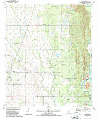
1987 Map of Strong
USGS Topo · Published 1987About this map
The Tombigbee River corridor in Northeast Mississippi is defined here by the intersection of traditional agriculture and significant industrial engineering. The Gulf and Mississippi railroad line cuts through the western landscape, connecting the small settlements of Strong and Whites. This map documents a transformative moment for the river valley, showing the Columbus Lake portion of the Tennessee-Tombigbee Waterway. This massive public works project altered the local hydrology, as seen in the sprawling Tombigbee River channel and adjacent disposal areas.
Find a feature on this map
48 named features on this map. Tap any name to fly to it.
Don’t see what you’re looking for? This feature index may not catch every label — zoom into the map to look around manually.
Map Details
Editions of this 1987 Strong Map
This is the sole edition of this map. No revisions or reprints were ever made.
Other maps of this area

1953 · West Point
USGS Topo · 1:250,000

1958 · West Point
USGS Topo · 1:250,000

1959 · West Point
USGS Topo · 1:62,500

1960 · Caledonia
USGS Topo · 1:62,500

1963 · West Point
USGS Topo · 1:250,000

1966 · Aberdeen
USGS Topo · 1:24,000

1966 · Amory SW
USGS Topo · 1:24,000

1966 · Prairie
USGS Topo · 1:24,000

1982 · West Point
USGS Topo · 1:100,000

1984 · West Point
USGS Topo · 1:250,000