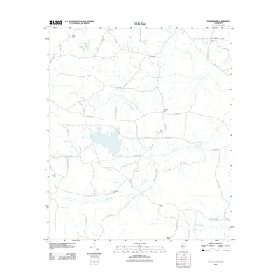
2012 Map of Stronghope
USGS Topo · Published 2012About this map
Stronghope and Woolworth anchor this 2012 study of the Mississippi landscape, where rural life is defined by a dense network of country roads and small family cemeteries. The terrain is intricately carved by several waterways, most notably Bahala Cr and its tributaries like Little Bahala Cr and Little Beaverdam Cr. These creeks dictate the placement of early settlements and gathering places, such as Sand Hill and Rafn.
Find a feature on this map
68 named features on this map. Tap any name to fly to it.
Don’t see what you’re looking for? This feature index may not catch every label — zoom into the map to look around manually.
Map Details
Editions of this 2012 Stronghope Map
This is the sole edition of this map. No revisions or reprints were ever made.
Other maps of this area

1953 · Natchez
USGS Topo · 1:250,000

1956 · Natchez
USGS Topo · 1:250,000

1959 · Natchez
USGS Topo · 1:250,000

1963 · Hazlehurst
USGS Topo · 1:24,000

1963 · Shady Grove
USGS Topo · 1:24,000

1970 · Nola
USGS Topo · 1:24,000

1971 · Oma
USGS Topo · 1:24,000
1971 · Georgetown
USGS Topo · 1:24,000

1972 · Fair Oak Springs
USGS Topo · 1:24,000
1972 · Stronghope
USGS Topo · 1:24,000