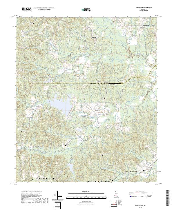
2024 Map of Stronghope
USGS Topo · Published 2024About this map
The winding courses of Bahala Creek and Little Bahala Creek define the rural character of this borderland between Copiah and Lincoln counties. Established community nodes like Stronghope and Sand Hill appear as small clusters of settlement within a landscape heavily crisscrossed by timber-access routes and local lanes. The presence of numerous family-named landmarks and rural congregations, including the Little Bahala Baptist Church and Franklin Chapel, points to the region's deep-rooted social fabric. Genealogists will find particular value in the distribution of family and church burial grounds across the quadrangle, from the Stronghope Cem in the north to the Warren Cem and Thompson Cem further south. These features, alongside small place names like Woolworth and Rafn, highlight the persistence of small-scale rural hamlets throughout the early 21st century.
Find a feature on this map
70 named features on this map. Tap any name to fly to it.
Don’t see what you’re looking for? This feature index may not catch every label — zoom into the map to look around manually.
Map Details
Editions of this 2024 Stronghope Map
This is the sole edition of this map. No revisions or reprints were ever made.
Other maps of this area

1953 · Natchez
USGS Topo · 1:250,000

1956 · Natchez
USGS Topo · 1:250,000

1959 · Natchez
USGS Topo · 1:250,000

1963 · Hazlehurst
USGS Topo · 1:24,000

1963 · Shady Grove
USGS Topo · 1:24,000

1970 · Nola
USGS Topo · 1:24,000

1971 · Oma
USGS Topo · 1:24,000
1971 · Georgetown
USGS Topo · 1:24,000

1972 · Fair Oak Springs
USGS Topo · 1:24,000
1972 · Stronghope
USGS Topo · 1:24,000