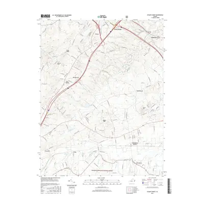
2016 Map of Stuarts Draft
USGS Topo · Published 2016About this map
Stuarts Draft and the southern outskirts of Staunton anchor this 2016 survey of Augusta County, where the Shenandoah Valley floor begins its rise toward the Blue Ridge. The landscape is defined by the winding course of Christians Creek and the South River, which drain a complex network of smaller runs like Loves Run and Coles Run. In the southern reaches, the map captures the transition into the George Washington National Forest, where the terrain steepens and becomes densely wooded. Established communities such as Fishersville and Jolivue reflect the area's ongoing residential growth along major corridors, yet smaller locales like Folly Mills, Barterbrook, and White Hill maintain their distinct identities. This edition provides a high-resolution view of the modern road network, from the interstate to rural lanes like Old Greenville Road, marking the evolution of this historic agricultural and industrial region.
Find a feature on this map
127 named features on this map. Tap any name to fly to it.
Don’t see what you’re looking for? This feature index may not catch every label — zoom into the map to look around manually.
Map Details
Editions of this 2016 Stuarts Draft Map
This is the sole edition of this map. No revisions or reprints were ever made.
Other maps of this area

1892 · Buckingham
USGS Topo · 1:125,000

1892 · Harrisonburg
USGS Topo · 1:125,000

1894 · Staunton
USGS Topo · 1:125,000

1894 · Lexington
USGS Topo · 1:125,000

1934 · Waynesboro
USGS Topo · 1:48,000

1936 · Vesuvius
USGS Topo · 1:48,000

1939 · Waynesboro
USGS Topo · 1:62,500

1941 · Vesuvius
USGS Topo · 1:62,500

1943 · Lovingston
USGS Topo · 1:62,500

1944 · Staunton
USGS Topo · 1:62,500