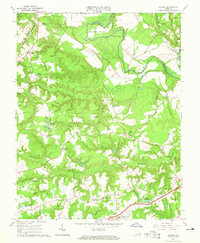
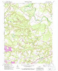
1964 Map of Studley
USGS Topo · Published 1965About this map
The Pamunkey River snakes along the northern boundary of this Hanover County landscape, defining the deep river bends of Sutton Neck and Crump Neck. This mid-century survey captures a rural Tidewater region transitioning between traditional agriculture and modern infrastructure, evidenced by the numerous Gravel Pits and several small aircraft Landing Strips dotting the terrain. The central settlement of Studley serves as a local anchor, surrounded by established community landmarks such as Enon Church and the State Industrial School.
Find a feature on this map
51 named features on this map. Tap any name to fly to it.
Don’t see what you’re looking for? This feature index may not catch every label — zoom into the map to look around manually.
Map Details
Editions of this 1964 Studley Map
5 editions found
Other maps of this area

1894 · Richmond
USGS Topo · 1:62,500

1895 · Richmond
USGS Topo · 1:62,500

1918 · Doswell
USGS Topo · 1:62,500

1918 · Aylett
USGS Topo · 1:62,500

1920 · King William
USGS Topo · 1:62,500

1933 · Aylett
USGS Topo · 1:62,500

1934 · Seven Pines
USGS Topo · 1:24,000

1934 · Richmond
USGS Topo · 1:24,000

1938 · Seven Pines
USGS Topo · 1:31,680

1938 · Studley
USGS Topo · 1:31,680