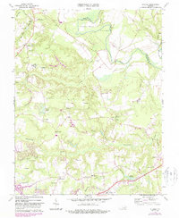
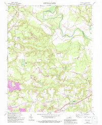
1964 Map of Studley
USGS Topo · Published 1987About this map
Studley and the rural stretches of Hanover County appear in detail in this 1960s survey, updated with revisions through the mid-1980s. The landscape is defined by the winding Pamunkey River and its major tributaries, including Totopotomoy Creek and Crump Creek. A dense network of country roads connects family-named landmarks and small settlements such as Rural Point, Pollard, and Newman. This region’s deep history is evidenced by numerous spiritual and civic centers, from Chestnut Grove Ch to Salem Ch, and institutional sites like the State Industrial School.
Find a feature on this map
54 named features on this map. Tap any name to fly to it.
Don’t see what you’re looking for? This feature index may not catch every label — zoom into the map to look around manually.
Map Details
Editions of this 1964 Studley Map
5 editions found
Other maps of this area

1894 · Richmond
USGS Topo · 1:62,500

1895 · Richmond
USGS Topo · 1:62,500

1918 · Doswell
USGS Topo · 1:62,500

1918 · Aylett
USGS Topo · 1:62,500

1920 · King William
USGS Topo · 1:62,500

1933 · Aylett
USGS Topo · 1:62,500

1934 · Seven Pines
USGS Topo · 1:24,000

1934 · Richmond
USGS Topo · 1:24,000

1938 · Seven Pines
USGS Topo · 1:31,680

1938 · Studley
USGS Topo · 1:31,680