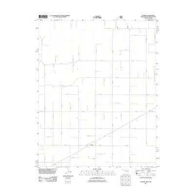
2011 Map of Sturgis
USGS Topo · Published 2011About this map
The settlement of Sturgis serves as the primary focal point of this 2011 survey, situated at the intersection of several key county roads in the Oklahoma Panhandle. The landscape is defined by the section line road grid typical of the High Plains, with major arteries such as N0500 Rd and E0080 Rd facilitating travel across the agricultural expanse. This survey captures the region just north of the Texas border, where the land transitions from flat tabletop fields to the drainage basin of Goff Creek. The creek bed meanders through the southern portion of the quadrangle, providing a distinct contrast to the rigid geometry of the surrounding road network. Local researchers can trace the connectivity of rural homesteads and farmstead access points via numerous designated routes like N0545 Rd and E0060 RD|E0060 Rd, which reflect the persistent infrastructure of Cimarron County's farming economy.
Find a feature on this map
38 named features on this map. Tap any name to fly to it.
Don’t see what you’re looking for? This feature index may not catch every label — zoom into the map to look around manually.
Map Details
Editions of this 2011 Sturgis Map
This is the sole edition of this map. No revisions or reprints were ever made.
Other maps of this area

1892 · Vilas
USGS Topo · 1:125,000

1954 · Perryton
USGS Topo · 1:250,000

1954 · Dalhart
USGS Topo · 1:250,000

1955 · La Junta
USGS Topo · 1:250,000

1955 · Dodge City
USGS Topo · 1:250,000

1958 · Perryton
USGS Topo · 1:250,000

1958 · La Junta
USGS Topo · 1:250,000

1958 · Dodge City
USGS Topo · 1:250,000

1958 · Dalhart
USGS Topo · 1:250,000

1959 · Dodge City
USGS Topo · 1:250,000