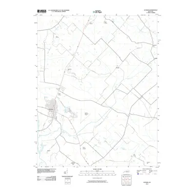
2010 Map of Sturgis
USGS Topo · Published 2010About this map
Sturgis serves as the primary hub in this Union County landscape, where a grid of streets meets the winding course of the Tradewater River. The area is defined by a series of named elevations such as Blueberry Hill and Carding Machine Hill, which rise above the agricultural flats and creek bottoms. This 2010 survey documents a distribution of small rural settlements including Bethel, Arnold, and Hazel, each linked by a network of named country roads and former rail corridors like Railroad Bed Rd.
Find a feature on this map
44 named features on this map. Tap any name to fly to it.
Don’t see what you’re looking for? This feature index may not catch every label — zoom into the map to look around manually.
Map Details
Editions of this 2010 Sturgis Map
This is the sole edition of this map. No revisions or reprints were ever made.
Other maps of this area

1907 · Morganfield
USGS Topo · 1:62,500

1909 · Providence
USGS Topo · 1:62,500

1916 · Shawneetown
USGS Topo · 1:62,500

1916 · Fords Ferry
USGS Topo · 1:62,500

1921 · Fords Ferry
USGS Topo · 1:48,000

1925 · Cave In Rock
USGS Topo · 1:62,500

1949 · Paducah
USGS Topo · 1:250,000

1949 · Morganfield
USGS Topo · 1:24,000

1950 · Paducah
USGS Topo · 1:250,000

1951 · Waverly
USGS Topo · 1:24,000